Philippinespage 2

Place · 141 articles
Share

Coverage, page 2

page 2 of 7

School shooting in Philippines: Three students, including gunman, killed

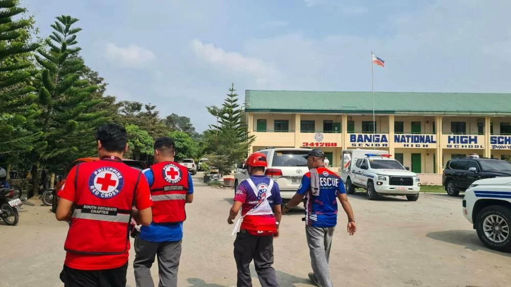
MANILA: Three students were killed in a school shooting in the southern Philippines on Friday, including a 16-year-old suspected gunman who turned the gun on himself, provincial officials said. Eight others were injured, with ⁠four in critical condition, and all the victims were students aged 14 to 17, said Albert Palencia, mayor of Banga town in South Cotabato, where the shooting took place. The incident follows two fatal gun ‌incidents since June at schools in the Philippines, where school shootings were previously rare. "The suspect supposedly sat beside his friends and told them to go home 'because ‌after lunch, I will be executing my plan'. His friends ‌laughed because the shooter was a known joker," Palencia told Reuters. "After ‌lunch, he started shooting students. ‌He hit 10 students before killing himself," Palencia added. Last month, a student live-streamed himself shooting and killing another student in ‌a classroom in Zamboanga in the country's south before taking ⁠his own life. In June, at least three students were killed and about 20 others injured in an attack at a public high school in Tacloban, where two ⁠classmates opened fire ⁠on campus. The Philippines has relatively strict gun ownership regulations, including background checks and psychological evaluation requirements, although illegal firearms remain in circulation. The Friday shooting also follows ⁠a high-profile incident in Thailand in August, where a student went on a shooting rampage at a school on the outskirts of the capital Bangkok. South Cotabato governor Reynaldo Tamayo urged parents to ensure guns were kept out of reach of minors. "We need to be responsible ‌in storing firearms. Gun owners, in particular, must make sure that minors do not have access to them," Tamayo told Reuters by phone. "We cannot expect a handful of security personnel to monitor thousands of students. We need to work together because otherwise this will be very difficult for us to address."

MBMobile BusinessReuters18 Sept

Philippines: DSWD DROMIC Report #94 on the Combined Effects of Enhanced Southwest Monsoon and Tropical Cyclones “Luis”, “Maymay”, “Neneng”, and “Pilandok” as of 18 September 2026, 6AM

Country: Philippines Source: Government of the Philippines Please refer to the attached file. I. Situation Overview On 30 July 2026 at 4:00 PM, the trough of a Low Pressure Area (LPA 07f) affected the eastern sections of Visayas and Mindanao. On the same day, the trough of the LPA brought continuous heavy rainfall, resulting in flash floods in Zamboanga City. On 01 August 2026, the LPA located east of Infanta, Quezon developed into Tropical Depression (TD) Luis. On 02 August 2026, TD Luis brought moderate to heavy rainfall, strong winds, and rough sea conditions across Northern and Central Luzon, resulting in flooding in low-lying and flood-prone areas, particularly in the Cagayan Valley Region. Continuous moderate to heavy rainfall was also experienced in parts of La Union and Pangasinan. The effects of TD Luis also extended to the Bicol Region, where a Yellow Rainfall Warning was raised over Camarines Norte due to the risk of flooding in low-lying areas and communities near river channels. Moderate to heavy rainfall also affected parts of Masbate, Camarines Sur, and Sorsogon. Meanwhile, the Philippine Coast Guard (PCG) suspended sea travel for all types of vessels in the Province of Catanduanes and the eastern portion of Camarines Norte due to hazardous sea conditions. On 03 August 2026, TD Luis brought rains accompanied by gusty winds over the Province of Aurora, while the rest of Central Luzon experienced cloudy skies with scattered rain showers and thunderstorms associated with the tropical cyclone (TC). At 11:00 PM on the same day, TD Luis weakened into a LPA while in the vicinity of Peñablanca, Cagayan. On 04 August 2026, the LPA west of La Union developed into TD “Maymay”. The TD remained over the sea west of La Union, intensified into a Tropical Storm (TS), and gradually moved northward and east-northeastward toward the Ilocos area on the following day. On 06 August 2026, “Maymay” made landfall near Magsingal, Ilocos Sur, traversed Northern Luzon and then moved over the Philippine Sea while weakening into a TD. By 07 August 2026, “Maymay” had weakened into an LPA over the Philippine Sea. On 08 August 2026, the effects of the Southwest Monsoon (SWM) continued to affect the country, bringing heavy rains, flooding, and strong winds in several areas. In Western Visayas, flooding and strong winds were reported in Antique, Aklan, and Iloilo City, while sea trips were cancelled, leaving passengers stranded in several ports. A tornado also struck parts of Iloilo City, damaging roofs, power lines, and trees. Flooding was likewise reported in several areas in the National Capital Region (NCR). On 18 August 2026, the LPA located 1,025 km East of Extreme Northern Luzon (20.4°N, 131.8°E) developed into TD “Neneng”. On 19 August 2026, TD “Neneng” slightly intensified as it moved northwestward over the sea east of Batanes. On 20 August 2026, TD “Neneng” weakened into a LPA and exited the Philippine Area of Responsibility (PAR). On 28 August 2026, an LPA was estimated based on all available data at 720 km East of Itbayat, Batanes. On 30 August 2026, the LPA located 1,225 km East of Extreme Northern Luzon developed into TD “Pilandok”. On 01 September 2026, 8:00 AM, Tropical Depression "PILANDOK" intensified into a Tropical Storm with the international name "KROVANH" . On 03 September 2026, 4:30 AM. Tropical Storm "PILANDOK" exited PAR. In response, the Department of Social Welfare and Development (DSWD), through its Field Offices (FOs) Cordillera Administrative Region (CAR), I, II, III, CALABARZON, MIMAROPA, V, VI, VIII, IX, and NCR, is in close coordination with the affected Local Government Units (LGUs), to monitor the situation and ensure the provision of necessary assistance to the affected population. Meanwhile, the DSWD FOs NCR, CAR, I, II, III, CALABARZON, MIMAROPA, V, VI, VIII and IX have already provided relief assistance to address the immediate needs of the affected families and individuals. Additionally, the DSWD ensures the protection of Internally Displaced Persons (IDPs) through Camp Coordination and Camp Management (CCCM) and dedicated IDP Protection mechanisms, while continuously working with affected LGUs to support response and recovery efforts.

ReliefWebReliefWebGovernment of the Philippines18 Sept

Philippines: DSWD DROMIC Report #93 on the Combined Effects of Enhanced Southwest Monsoon and Tropical Cyclones “Luis”, “Maymay”, “Neneng”, and “Pilandok” as of 17 September 2026, 6PM

Country: Philippines Source: Government of the Philippines Please refer to the attached file. I. Situation Overview On 30 July 2026 at 4:00 PM, the trough of a Low Pressure Area (LPA 07f) affected the eastern sections of Visayas and Mindanao. On the same day, the trough of the LPA brought continuous heavy rainfall, resulting in flash floods in Zamboanga City. On 01 August 2026, the LPA located east of Infanta, Quezon developed into Tropical Depression (TD) Luis. On 02 August 2026, TD Luis brought moderate to heavy rainfall, strong winds, and rough sea conditions across Northern and Central Luzon, resulting in flooding in low-lying and flood-prone areas, particularly in the Cagayan Valley Region. Continuous moderate to heavy rainfall was also experienced in parts of La Union and Pangasinan. The effects of TD Luis also extended to the Bicol Region, where a Yellow Rainfall Warning was raised over Camarines Norte due to the risk of flooding in low-lying areas and communities near river channels. Moderate to heavy rainfall also affected parts of Masbate, Camarines Sur, and Sorsogon. Meanwhile, the Philippine Coast Guard (PCG) suspended sea travel for all types of vessels in the Province of Catanduanes and the eastern portion of Camarines Norte due to hazardous sea conditions. On 03 August 2026, TD Luis brought rains accompanied by gusty winds over the Province of Aurora, while the rest of Central Luzon experienced cloudy skies with scattered rain showers and thunderstorms associated with the tropical cyclone (TC). At 11:00 PM on the same day, TD Luis weakened into a LPA while in the vicinity of Peñablanca, Cagayan. On 04 August 2026, the LPA west of La Union developed into TD “Maymay”. The TD remained over the sea west of La Union, intensified into a Tropical Storm (TS), and gradually moved northward and east-northeastward toward the Ilocos area on the following day. On 06 August 2026, “Maymay” made landfall near Magsingal, Ilocos Sur, traversed Northern Luzon and then moved over the Philippine Sea while weakening into a TD. By 07 August 2026, “Maymay” had weakened into an LPA over the Philippine Sea. On 08 August 2026, the effects of the Southwest Monsoon (SWM) continued to affect the country, bringing heavy rains, flooding, and strong winds in several areas. In Western Visayas, flooding and strong winds were reported in Antique, Aklan, and Iloilo City, while sea trips were cancelled, leaving passengers stranded in several ports. A tornado also struck parts of Iloilo City, damaging roofs, power lines, and trees. Flooding was likewise reported in several areas in the National Capital Region (NCR). On 18 August 2026, the LPA located 1,025 km East of Extreme Northern Luzon (20.4°N, 131.8°E) developed into TD “Neneng”. On 19 August 2026, TD “Neneng” slightly intensified as it moved northwestward over the sea east of Batanes. On 20 August 2026, TD “Neneng” weakened into a LPA and exited the Philippine Area of Responsibility (PAR). On 28 August 2026, an LPA was estimated based on all available data at 720 km East of Itbayat, Batanes. On 30 August 2026, the LPA located 1,225 km East of Extreme Northern Luzon developed into TD “Pilandok”. On 01 September 2026, 8:00 AM, Tropical Depression "PILANDOK" intensified into a Tropical Storm with the international name "KROVANH" . On 03 September 2026, 4:30 AM. Tropical Storm "PILANDOK" exited PAR. In response, the Department of Social Welfare and Development (DSWD), through its Field Offices (FOs) Cordillera Administrative Region (CAR), I, II, III, CALABARZON, MIMAROPA, V, VI, VIII, IX, and NCR, is in close coordination with the affected Local Government Units (LGUs), to monitor the situation and ensure the provision of necessary assistance to the affected population. Meanwhile, the DSWD FOs NCR, CAR, I, II, III, CALABARZON, MIMAROPA, V, VI, VIII and IX have already provided relief assistance to address the immediate needs of the affected families and individuals. Additionally, the DSWD ensures the protection of Internally Displaced Persons (IDPs) through Camp Coordination and Camp Management (CCCM) and dedicated IDP Protection mechanisms, while continuously working with affected LGUs to support response and recovery efforts.

ReliefWebReliefWebGovernment of the Philippines18 Sept
R

Major disasters disrupted education for at least 13 million children in six countries in three months as Venezuela reopens schools

Countries: Venezuela (Bolivarian Republic of), Colombia, Indonesia, Japan, Nepal, Philippines Source: Save the Children CARACAS, Venezuela, 17 September 2026 – Education was disrupted for about 13 million children over the past three months as Nepal, Japan, Colombia, Venezuela, Indonesia, and the Philippines were all hit by major natural or climate disasters such as earthquakes, floods, or wildfires , said Save the Children. In many countries where the disasters stuck, classes were in session at the time such as in Nepal where children were forced to flee flash flooding. In others, schools were approaching the end of year holidays such as in Venezuela where pupils return to class this week and learning disruptions are only now being felt. Analysing various data sources, Save the Children looked at the impact of these disasters over the past three months and estimated that about 13 million children saw their learning suspended, transferred online, reduced or disrupted in other ways, with some continuing to see their education impacted.[1] In Venezuela, students and teachers said that they were feeling anxious as they returned to school for the new academic year following the twin earthquakes that hit the country on 24 June, killing more than 6,500 people. The earthquakes, the most powerful in a century, halted education for more than 21,000 students [2] and disrupted learning for one million**,** or about one in every eight school-aged child, Save the Children said. Teachers from La Guaira, a coastal region badly hit in northern Venezuela, said it was important to continue efforts to ensure that schools can provide supportive environments for children returning after the earthquakes although some schools have suffered structural damage and cannot reopen. Alondra*, 37, a teacher in Venezuela and mother to nine-year-old Emma*, is worried that the disruption will force students into overcrowded schools, affecting both learning quality and recreational opportunities. “My daughter's education is paramount, of course, and I'm not going to take her out of school, especially not because of this [earthquake],” she said. Alondra has been taking Emma to a Save the Children safe space in the months since the earthquake so she can continue learning and playing with other children her own age. Save the Children in Venezuela and its national partners have helped over 93,970 people** since the earthquakes including through psychosocial support, health support, and community engagement activities. The child rights organisation will also start rehabilitating learning spaces and schools and training teachers to support children affected by the earthquakes. Four other powerful earthquakes in Colombia, the Philippines, Indonesia and in Japan disrupted education for about 4 million children out of the 13 million children. A 7.8 magnitude earthquake struck the southern Philippines on 8 June, the first day back to school after the country’s summer break, disrupting education. Since then, Save the Children has reached more than 8,800 people, including 3,900 children, providing support including household items, hygiene kits and temporary learning spaces. Floods brought about by this season's monsoon in the Philippines also affected nearly 7 million students who saw classes suspended including in the capital Manila and several provinces, on and off, for almost two weeks, while almost 900 schools sustained damaged.[3] Tatiana Betancourt, an education officer at Save the Children Colombia, said: “Families temporarily settled in spaces that do not have adequate security and protection conditions affecting educational institutions, limiting children's and adolescents' access to safe learning spaces. Emotional effects on children, caregivers and families include fear, stress and uncertainty generated by the emergency.” In Colombia, the earthquake’s damage to education infrastructure disrupted access to education for over 1 million children and compounded pre-existing poverty. While about 80% of children have returned to learning through partial, hybrid, or alternating attendance, more than 300,000 children are estimated to be facing heightened protection risks, including recruitment by armed groups. [4] Save the Children in Colombia is focusing on supporting the safe return to schools wherever feasible and is supporting temporary learning arrangements through local education partners including temporary learning tents in affected areas such as Chocó. Flash floods in Nepal in August which hit as children were either on their way to school or starting their lessons, killed at least 1,350 people with about 4,800 still missing.[5] While some schools closed by the floods in Nepal have begun to reopen, many displaced children are not currently able to attend classes as they are not registered for schools in areas they moved to. Save the Children has supported more than 6,000 people across Nuwakot, Dhading and Rasuwa districts with essential items and has set up two temporary learning spaces to help children learn. In Japan, Save the Children set up child friendly spaces to provide children with a safe environment to play and recover following the 28 July earthquake in Kumamoto Prefecture, southern Japan, among other support. When disasters or climate emergencies disrupt children’s education, as they have for children in Nepal, Venezuela, Colombia and elsewhere this summer, children must be able to continue their education through crisis. Governments also need stronger, more inclusive, and resilient education systems that can last. Save the Children is calling on world leaders gathering in New York for the UN General Assembly this month to pledge at least US $5 billion to the Global Partnership for Education to help reach about 750 million children across 96 countries by 2030 by strengthening education systems. The child rights organisation is also calling on leaders to pledge US$600 million this November for Education Cannot Wait, so children in crisis can continue learning. *Names changed for anonymity References: **As of 11 September 2026. Methodology: Over 13 million figure is based on looking at major or high-profile disasters between 1 June and early September where there was a publicly reported impact on education. Disasters included earthquakes in Venezuela (1 million children’s education impacted) ; Colombia ( 1 million ) Indonesia ( over 116,000 ), Japan (about 200,000) and the Philippines ( 3 million ), wildfires in Indonesia ( 1.4 million ), monsoon flooding in the Philippines ( 6.8 million ) and flash floods in Nepal ( 19,000 ). For Japan, the number of children with disrupted education is estimated based on data from Ministry of Education, Culture, Sports, Science and Technology (MEXT) on 650 affected schools, using the average number of students per school in Japan. [1, 5] NEPAL: https://www.unocha.org/publications/report/nepal/nepal-rasuwa-flood-situation-report-no-7-8-september-2026 [2] Save the Children Rapid Needs Assessment (RNA) August 2026 + UNICEF assessment indicates that more than 432 schools suffered physical damage to their infrastructure. In the state of La Guaira, out of the 290 public and independent schools surveyed in the coastal area, 62 sustained structural damage or suffered total physical collapse. [3] EDCOM 2 - The Second Congressional Commission on Education: https://www.facebook.com/edcom2ph/posts/pfbid0xPVJkvHr9HAYRbofaMZcX3kDNtVcqeiHiq3yCtUSd2pSiYpwMCBMcxMoGrq1GH5fl [4] IRC, 14 Aug 2026: https://www.rescue.org/press-release/irc-launches-health-child-protection-response-colombia-earthquake-death-toll-rises

ReliefWebReliefWebSave the Children18 Sept

World: State of Global Water Resources 2025

Countries: World, Argentina, Armenia, Australia, Chile, Cuba, Democratic Republic of the Congo, Djibouti, Dominican Republic, Eritrea, Ethiopia, France, Haiti, Indonesia, Iran (Islamic Republic of), Jamaica, Jordan, Malaysia, Nigeria, Pakistan, Philippines, Somalia, South Africa, Sri Lanka, Syrian Arab Republic, Thailand, Türkiye, United States of America, Viet Nam Source: World Meteorological Organization Please refer to the attached file. WMO: Recent water trends have serious future implications The WMO State of Global Water Resources report is a comprehensive science-based annual assessment of the hydrological cycle and extreme events in 2025 and over the past five years. 2025 was one of driest years for river discharge in 35 years Past 7 years have seen abnormal river flows Water storage on Earth’s land surface has decreased in past 10 years Widespread glacier loss across all regions for 4th consecutive year Asia and Africa are the regions most affected by water-related disasters Water data availability has improved, but gaps remain in hard hit areas Geneva, Switzerland, 17 September 2026 (WMO) – Rivers across the globe in 2025 had one of the driest years in more than three decades, according to a new report from the World Meteorological Organization (WMO). It shows a continuation of the long-term decline in Earth’s freshwater storage and in glacier retreat - trends with serious implications for people and economies in the future. The WMO State of Global Water Resources Report shows that the water cycle has become more erratic and unpredictable, swinging between too little or too much. The past seven years have seen the fewest rivers with “normal” flows since 1991. Asia and Africa together accounted for at least half of all recorded water-related extreme events and more than 80% of reported associated deaths over the past five years, it says. The report provides a comprehensive, science-based assessment of the entire water cycle loop, including river discharge, groundwater, evapotranspiration, land water storage, and snow and ice, as well as high-impact events. It covers the year 2025 and summarizes findings of the past five years since it was first published. Some parts of this cycle are fast – such as precipitation, river flow, soil moisture – they respond to weather within days or weeks. Others, like groundwater, glaciers and seasonal snowpack, are slow, they accumulate or deplete over seasons to decades or longer. Traditionally these slow reserves have acted as the planet's savings account: a buffer that absorbs bad years so that a single drought or a single dry season does not translate directly into a water crisis,” said WMO Secretary-General Celeste Saulo. “We are depleting that savings account. Global terrestrial water storage has shown a declining trend since 2014–2016 - a persistent, decade-long signal. For the fourth consecutive year, every major glaciated region on Earth lost ice mass. Groundwater tells a similar story: nearly two-thirds of monitored wells worldwide showed conditions outside the historical norm in 2025, and the balance shifted further toward deficit compared with 2024, not toward recovery,” said Celeste Saulo. “At the same time, we are seeing more water-related disasters. The strengthening El Niño will increase the risk of drought in some areas, and flooding in others,” she said. The report highlights some major areas of concern: 2025 was one of driest years for river discharge globally in 35 years, with below-normal flows over 36% of global basin area. This is based on data from simulations from 13 global hydrological models, driven by observed weather data. For the seventh year in a row, the number of river basins with “normal” conditions was in a clear minority: ranging between 34-38%, compared to the average of 46% between 1991-2020, according to the report. Terrestrial water storage – the total amount of water stored in groundwater, lakes and rivers, soil moisture, vegetation and ice and snow – has been in decline since mid-2010s. 2025 marked the fourth consecutive year with widespread glacier loss across all regions – leading to short term hazards like floods and long-term water insecurity. Between 2023-2025 glaciers lost mass in each reporting year with cumulative global glacier mass loss at 1400 Gigatonnes of water. This is roughly equal to the water required to fill about 560 million Olympic-sized swimming pools, or about one third of annual freshwater withdrawals. In each of the past five years, National Meteorological and Hydrological Services around the globe reported record-breaking floods and droughts. Some places have had no recovery time between one event and the next. “Water respects no borders. A river basin's water balance depends on what happens in another country. A glacier's retreat in one country reshapes water availability for populations hundreds of kilometers downstream. This is precisely why we need shared data, shared standards, and shared early warning — the exact function WMO exists to perform,” said Celeste Saulo. Dozens of experts from National Meteorological and Hydrological Services, data centres, researchers and partner institutions shared in situ observations, model outputs and space-based data and contributed to the report, which has expanded from three to 15 hydrological variables since the first edition in 2021. Country coverage has greatly expanded. However, Africa and Asia are still among the least represented regions in terms of hydrological observations in the report, even though they are most affected by extremes. 2025 was one of the warmest years on record. A weak La Niña emerged towards the end of the year after neutral conditions, and there was a predominantly negative Indian Ocean Dipole, which influenced precipitation. River basins Across the five reporting years (2021-2025), recurring below-normal river discharge was observed in major parts of the Amazon and La Plata basins, North America, Central and East Africa, Central Asia and the Middle East. Annual river discharge in 2025 was above-normal to much-above-normal across South and South-East Asia and parts of northern South America. In Africa, there were above-normal flows in the Senegal, Niger, Lake Chad, Orange and Limpopo basins, but much-below-normal discharge in the Nile, Congo and Zambezi basins. Below-normal to much-below-normal river discharge affected several major regions, including much of North America, the La Plata and São Francisco basins of South America, Eastern European basins, the Middle East and Central Asia. Reservoir and lake levels followed similar geographical trends as for river basins. African lakes were largely much above normal, with Kariba a notable exception. Terrestrial water storage Terrestrial water storage shows a persistent negative trend since 2014-2016 with increasing area under below-normal conditions. Between 2021-2025 below-normal terrestrial water storage repeatedly affected the south-western United States, Patagonia and the subtropical Andes, the Ganges–Indus headwaters, North Africa, the Middle East, Central Asia and eastern China, while persistent positive anomalies occurred in parts of sub-Saharan Africa, the Sahel and the Tibetan Plateau. In 2025, it was below-normal in northern and southwestern North America, Patagonia, Eastern Europe, the Middle East, Central Asia, eastern Brazil, northern India, parts of Northern Europe, the Russian Federation, China and Northern Africa. La Plata in South America showed signs of partial recovery from the long-term drought. Much-above-normal storage continued from 2024 into 2025 in Central and Southern Africa. Groundwater levels Persistent groundwater deficits were observed during 2022–2025 in parts of the Americas, Europe, the Middle East, India, southern Africa and Australia. Persistent and widespread below-normal to much-below-normal groundwater levels were observed across Central and Eastern Europe, central United States, parts of Mexico, northern and central Chile, northeastern and central-western Brazil, northern South Africa, northwestern India and parts of southern Australia, pointing to a cumulative depletion with multi-year drying trend. There were above-normal to much-above-normal conditions include parts of France, much of Northern Europe, the southeastern United States, large parts of South Africa, South-East Asia, and eastern Australia. Snow cover and glaciers Snow conditions were below normal across Europe in 2025, whilst the Russian Federation and North America showed strong regional contrasts. In the hydrological year 2025, glaciers lost 408 (±132) Gigatonnes of mass, equivalent to 1.1 (±0.4) mm of sea-level rise. It marked the fourth consecutive year in which every major glaciated region recorded a net loss. Central Asia, South Asia West, Russian Arctic, Iceland, Western Canada and USA all recorded annual mass balances that ranked among the three most negative years on record for that region. Some regions dominated by smaller glaciers, such as the Caucasus, Western Canada and the USA, and Central Europe may already have reached “peak water conditions,” the threshold where the glacier reaches its maximum runoff due to melting. Extreme events From 2021-2025, South America’s La Plata and Amazon basins, the Middle East and the Greater Horn of Africa experienced persistent multi-year drought conditions, while severe floods repeatedly affected West and Central Africa and South-East Asia. Asia and Africa were the regions most affected by extreme hydrometeorological events in 2025, with several African countries experiencing major flooding for two (Nigeria) or three consecutive years (Democratic Republic of the Congo). South and South-East Asia was hit by compound tropical cyclones and intense monsoon, leading to up to 3 600 deaths across affected countries - Sri Lanka, Pakistan, Viet Nam, Indonesia, Thailand, Malaysia, the Philippines. Assessing the economic losses associated with water-related disasters remains challenging in many countries. Jamaica reported that hurricane Melissa resulted in losses equivalent to 41% of GDP. Cyclone Ditwah cost Sri Lanka around 4% of GDP. Severe drought gripped East Europe, the Mediterranean, and Middle East and also returned to the Greater Horn of Africa after one of the driest October–December seasons on record linked to La Niña and a negative Indian Ocean Dipole. Notes to Editors The WMO State of Global Water Resources 2025 report includes scientific contributions from dozens of WMO Members, partners and scientists. Full details of the datasets, references and institutions involved are available in the report. The WMO Secretariat wishes to thank everyone who dedicated their time and expertise to this report. The World Meteorological Organization is the United Nations System’s authoritative voice on Weather, Climate and Water. For further information, please contact: Clare Nullis, WMO media officer, cnullis@wmo.int, +41 79 709 13 97 Global Communication and Engagement Media Contact media@wmo.int

ReliefWebReliefWebWorld Meteorological Organization17 Sept

Philippines: DSWD DROMIC Report #92 on the Combined Effects of Enhanced Southwest Monsoon and Tropical Cyclones “Luis”, “Maymay”, “Neneng”, and “Pilandok” as of 17 September 2026, 6AM

Country: Philippines Source: Government of the Philippines Please refer to the attached file. I. Situation Overview On 30 July 2026 at 4:00 PM, the trough of a Low Pressure Area (LPA 07f) affected the eastern sections of Visayas and Mindanao. On the same day, the trough of the LPA brought continuous heavy rainfall, resulting in flash floods in Zamboanga City. On 01 August 2026, the LPA located east of Infanta, Quezon developed into Tropical Depression (TD) Luis. On 02 August 2026, TD Luis brought moderate to heavy rainfall, strong winds, and rough sea conditions across Northern and Central Luzon, resulting in flooding in low-lying and flood-prone areas, particularly in the Cagayan Valley Region. Continuous moderate to heavy rainfall was also experienced in parts of La Union and Pangasinan. The effects of TD Luis also extended to the Bicol Region, where a Yellow Rainfall Warning was raised over Camarines Norte due to the risk of flooding in low-lying areas and communities near river channels. Moderate to heavy rainfall also affected parts of Masbate, Camarines Sur, and Sorsogon. Meanwhile, the Philippine Coast Guard (PCG) suspended sea travel for all types of vessels in the Province of Catanduanes and the eastern portion of Camarines Norte due to hazardous sea conditions. On 03 August 2026, TD Luis brought rains accompanied by gusty winds over the Province of Aurora, while the rest of Central Luzon experienced cloudy skies with scattered rain showers and thunderstorms associated with the tropical cyclone (TC). At 11:00 PM on the same day, TD Luis weakened into a LPA while in the vicinity of Peñablanca, Cagayan. On 04 August 2026, the LPA west of La Union developed into TD “Maymay”. The TD remained over the sea west of La Union, intensified into a Tropical Storm (TS), and gradually moved northward and east-northeastward toward the Ilocos area on the following day. On 06 August 2026, “Maymay” made landfall near Magsingal, Ilocos Sur, traversed Northern Luzon and then moved over the Philippine Sea while weakening into a TD. By 07 August 2026, “Maymay” had weakened into an LPA over the Philippine Sea. On 08 August 2026, the effects of the Southwest Monsoon (SWM) continued to affect the country, bringing heavy rains, flooding, and strong winds in several areas. In Western Visayas, flooding and strong winds were reported in Antique, Aklan, and Iloilo City, while sea trips were cancelled, leaving passengers stranded in several ports. A tornado also struck parts of Iloilo City, damaging roofs, power lines, and trees. Flooding was likewise reported in several areas in the National Capital Region (NCR). On 18 August 2026, the LPA located 1,025 km East of Extreme Northern Luzon (20.4°N, 131.8°E) developed into TD “Neneng”. On 19 August 2026, TD “Neneng” slightly intensified as it moved northwestward over the sea east of Batanes. On 20 August 2026, TD “Neneng” weakened into a LPA and exited the Philippine Area of Responsibility (PAR). On 28 August 2026, an LPA was estimated based on all available data at 720 km East of Itbayat, Batanes. On 30 August 2026, the LPA located 1,225 km East of Extreme Northern Luzon developed into TD “Pilandok”. On 01 September 2026, 8:00 AM, Tropical Depression "PILANDOK" intensified into a Tropical Storm with the international name "KROVANH" . On 03 September 2026, 4:30 AM. Tropical Storm "PILANDOK" exited PAR. In response, the Department of Social Welfare and Development (DSWD), through its Field Offices (FOs) Cordillera Administrative Region (CAR), I, II, III, CALABARZON, MIMAROPA, V, VI, VIII, IX, and NCR, is in close coordination with the affected Local Government Units (LGUs), to monitor the situation and ensure the provision of necessary assistance to the affected population. Meanwhile, the DSWD FOs NCR, CAR, I, II, III, CALABARZON, MIMAROPA, V, VI, VIII and IX have already provided relief assistance to address the immediate needs of the affected families and individuals. Additionally, the DSWD ensures the protection of Internally Displaced Persons (IDPs) through Camp Coordination and Camp Management (CCCM) and dedicated IDP Protection mechanisms, while continuously working with affected LGUs to support response and recovery efforts.

ReliefWebReliefWebGovernment of the Philippines17 Sept

Philippines: DSWD DROMIC Report #90 on the Combined Effects of Enhanced Southwest Monsoon and Tropical Cyclones “Luis”, “Maymay”, “Neneng”, and “Pilandok” as of 16 September 2026, 6AM

Country: Philippines Source: Government of the Philippines Please refer to the attached file. I. Situation Overview On 30 July 2026 at 4:00 PM, the trough of a Low Pressure Area (LPA 07f) affected the eastern sections of Visayas and Mindanao. On the same day, the trough of the LPA brought continuous heavy rainfall, resulting in flash floods in Zamboanga City. On 01 August 2026, the LPA located east of Infanta, Quezon developed into Tropical Depression (TD) Luis. On 02 August 2026, TD Luis brought moderate to heavy rainfall, strong winds, and rough sea conditions across Northern and Central Luzon, resulting in flooding in low-lying and flood-prone areas, particularly in the Cagayan Valley Region. Continuous moderate to heavy rainfall was also experienced in parts of La Union and Pangasinan. The effects of TD Luis also extended to the Bicol Region, where a Yellow Rainfall Warning was raised over Camarines Norte due to the risk of flooding in low-lying areas and communities near river channels. Moderate to heavy rainfall also affected parts of Masbate, Camarines Sur, and Sorsogon. Meanwhile, the Philippine Coast Guard (PCG) suspended sea travel for all types of vessels in the Province of Catanduanes and the eastern portion of Camarines Norte due to hazardous sea conditions. On 03 August 2026, TD Luis brought rains accompanied by gusty winds over the Province of Aurora, while the rest of Central Luzon experienced cloudy skies with scattered rain showers and thunderstorms associated with the tropical cyclone (TC). At 11:00 PM on the same day, TD Luis weakened into a LPA while in the vicinity of Peñablanca, Cagayan. On 04 August 2026, the LPA west of La Union developed into TD “Maymay”. The TD remained over the sea west of La Union, intensified into a Tropical Storm (TS), and gradually moved northward and east-northeastward toward the Ilocos area on the following day. On 06 August 2026, “Maymay” made landfall near Magsingal, Ilocos Sur, traversed Northern Luzon and then moved over the Philippine Sea while weakening into a TD. By 07 August 2026, “Maymay” had weakened into an LPA over the Philippine Sea. On 08 August 2026, the effects of the Southwest Monsoon (SWM) continued to affect the country, bringing heavy rains, flooding, and strong winds in several areas. In Western Visayas, flooding and strong winds were reported in Antique, Aklan, and Iloilo City, while sea trips were cancelled, leaving passengers stranded in several ports. A tornado also struck parts of Iloilo City, damaging roofs, power lines, and trees. Flooding was likewise reported in several areas in the National Capital Region (NCR). On 18 August 2026, the LPA located 1,025 km East of Extreme Northern Luzon (20.4°N, 131.8°E) developed into TD “Neneng”. On 19 August 2026, TD “Neneng” slightly intensified as it moved northwestward over the sea east of Batanes. On 20 August 2026, TD “Neneng” weakened into a LPA and exited the Philippine Area of Responsibility (PAR). On 28 August 2026, an LPA was estimated based on all available data at 720 km East of Itbayat, Batanes. On 30 August 2026, the LPA located 1,225 km East of Extreme Northern Luzon developed into TD “Pilandok”. On 01 September 2026, 8:00 AM, Tropical Depression "PILANDOK" intensified into a Tropical Storm with the international name "KROVANH" . On 03 September 2026, 4:30 AM. Tropical Storm "PILANDOK" exited PAR. In response, the Department of Social Welfare and Development (DSWD), through its Field Offices (FOs) Cordillera Administrative Region (CAR), I, II, III, CALABARZON, MIMAROPA, V, VI, VIII, IX, and NCR, is in close coordination with the affected Local Government Units (LGUs), to monitor the situation and ensure the provision of necessary assistance to the affected population. Meanwhile, the DSWD FOs NCR, CAR, I, II, III, CALABARZON, MIMAROPA, V, VI, VIII and IX have already provided relief assistance to address the immediate needs of the affected families and individuals. Additionally, the DSWD ensures the protection of Internally Displaced Persons (IDPs) through Camp Coordination and Camp Management (CCCM) and dedicated IDP Protection mechanisms, while continuously working with affected LGUs to support response and recovery efforts.

ReliefWebReliefWebGovernment of the Philippines16 Sept

Philippines: DSWD DROMIC Report #89 on the Combined Effects of Enhanced Southwest Monsoon and Tropical Cyclones “Luis”, “Maymay”, “Neneng”, and “Pilandok” as of 15 September 2026, 6PM

Country: Philippines Source: Government of the Philippines Please refer to the attached file. I. Situation Overview On 30 July 2026 at 4:00 PM, the trough of a Low Pressure Area (LPA 07f) affected the eastern sections of Visayas and Mindanao. On the same day, the trough of the LPA brought continuous heavy rainfall, resulting in flash floods in Zamboanga City. On 01 August 2026, the LPA located east of Infanta, Quezon developed into Tropical Depression (TD) Luis. On 02 August 2026, TD Luis brought moderate to heavy rainfall, strong winds, and rough sea conditions across Northern and Central Luzon, resulting in flooding in low-lying and flood-prone areas, particularly in the Cagayan Valley Region. Continuous moderate to heavy rainfall was also experienced in parts of La Union and Pangasinan. The effects of TD Luis also extended to the Bicol Region, where a Yellow Rainfall Warning was raised over Camarines Norte due to the risk of flooding in low-lying areas and communities near river channels. Moderate to heavy rainfall also affected parts of Masbate, Camarines Sur, and Sorsogon. Meanwhile, the Philippine Coast Guard (PCG) suspended sea travel for all types of vessels in the Province of Catanduanes and the eastern portion of Camarines Norte due to hazardous sea conditions. On 03 August 2026, TD Luis brought rains accompanied by gusty winds over the Province of Aurora, while the rest of Central Luzon experienced cloudy skies with scattered rain showers and thunderstorms associated with the tropical cyclone (TC). At 11:00 PM on the same day, TD Luis weakened into a LPA while in the vicinity of Peñablanca, Cagayan. On 04 August 2026, the LPA west of La Union developed into TD “Maymay”. The TD remained over the sea west of La Union, intensified into a Tropical Storm (TS), and gradually moved northward and east-northeastward toward the Ilocos area on the following day. On 06 August 2026, “Maymay” made landfall near Magsingal, Ilocos Sur, traversed Northern Luzon and then moved over the Philippine Sea while weakening into a TD. By 07 August 2026, “Maymay” had weakened into an LPA over the Philippine Sea. On 08 August 2026, the effects of the Southwest Monsoon (SWM) continued to affect the country, bringing heavy rains, flooding, and strong winds in several areas. In Western Visayas, flooding and strong winds were reported in Antique, Aklan, and Iloilo City, while sea trips were cancelled, leaving passengers stranded in several ports. A tornado also struck parts of Iloilo City, damaging roofs, power lines, and trees. Flooding was likewise reported in several areas in the National Capital Region (NCR). On 18 August 2026, the LPA located 1,025 km East of Extreme Northern Luzon (20.4°N, 131.8°E) developed into TD “Neneng”. On 19 August 2026, TD “Neneng” slightly intensified as it moved northwestward over the sea east of Batanes. On 20 August 2026, TD “Neneng” weakened into a LPA and exited the Philippine Area of Responsibility (PAR). On 28 August 2026, an LPA was estimated based on all available data at 720 km East of Itbayat, Batanes. On 30 August 2026, the LPA located 1,225 km East of Extreme Northern Luzon developed into TD “Pilandok”. On 01 September 2026, 8:00 AM, Tropical Depression "PILANDOK" intensified into a Tropical Storm with the international name "KROVANH" . On 03 September 2026, 4:30 AM. Tropical Storm "PILANDOK" exited PAR. In response, the Department of Social Welfare and Development (DSWD), through its Field Offices (FOs) Cordillera Administrative Region (CAR), I, II, III, CALABARZON, MIMAROPA, V, VI, VIII, IX, and NCR, is in close coordination with the affected Local Government Units (LGUs), to monitor the situation and ensure the provision of necessary assistance to the affected population. Meanwhile, the DSWD FOs NCR, CAR, I, II, III, CALABARZON, MIMAROPA, V, VI, VIII and IX have already provided relief assistance to address the immediate needs of the affected families and individuals. Additionally, the DSWD ensures the protection of Internally Displaced Persons (IDPs) through Camp Coordination and Camp Management (CCCM) and dedicated IDP Protection mechanisms, while continuously working with affected LGUs to support response and recovery efforts.

ReliefWebReliefWebGovernment of the Philippines16 Sept

Chinese Solar Panels Drop to 12 Cents a Watt, Rooftop Installs Surge Worldwide

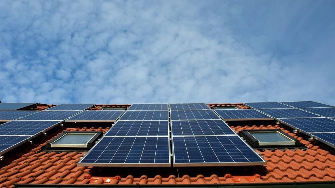
Chinese-made photovoltaic panels cost 12 cents a watt in 2026, down from $5-$6 at the turn of the millennium, and that price collapse is now powering rooftop solar installations from Pakistani cement plants to Philippine homes and Australian suburbs, according to the Financial Times. A Pakistani cement giant has cut its power costs by up to 40% with solar at its production sites, and rooftop solar capacity in the Philippines has nearly doubled in a year. At the same time, Africa is on pace to install record gigawatts, and Australia has installed…

OilPrice.comOilPrice.comAlex Kimani15 Sept